 |
OnLine Parish Clerks |
|
|
|
OnLine Parish Clerks |
|
Map of the County of Lancashire
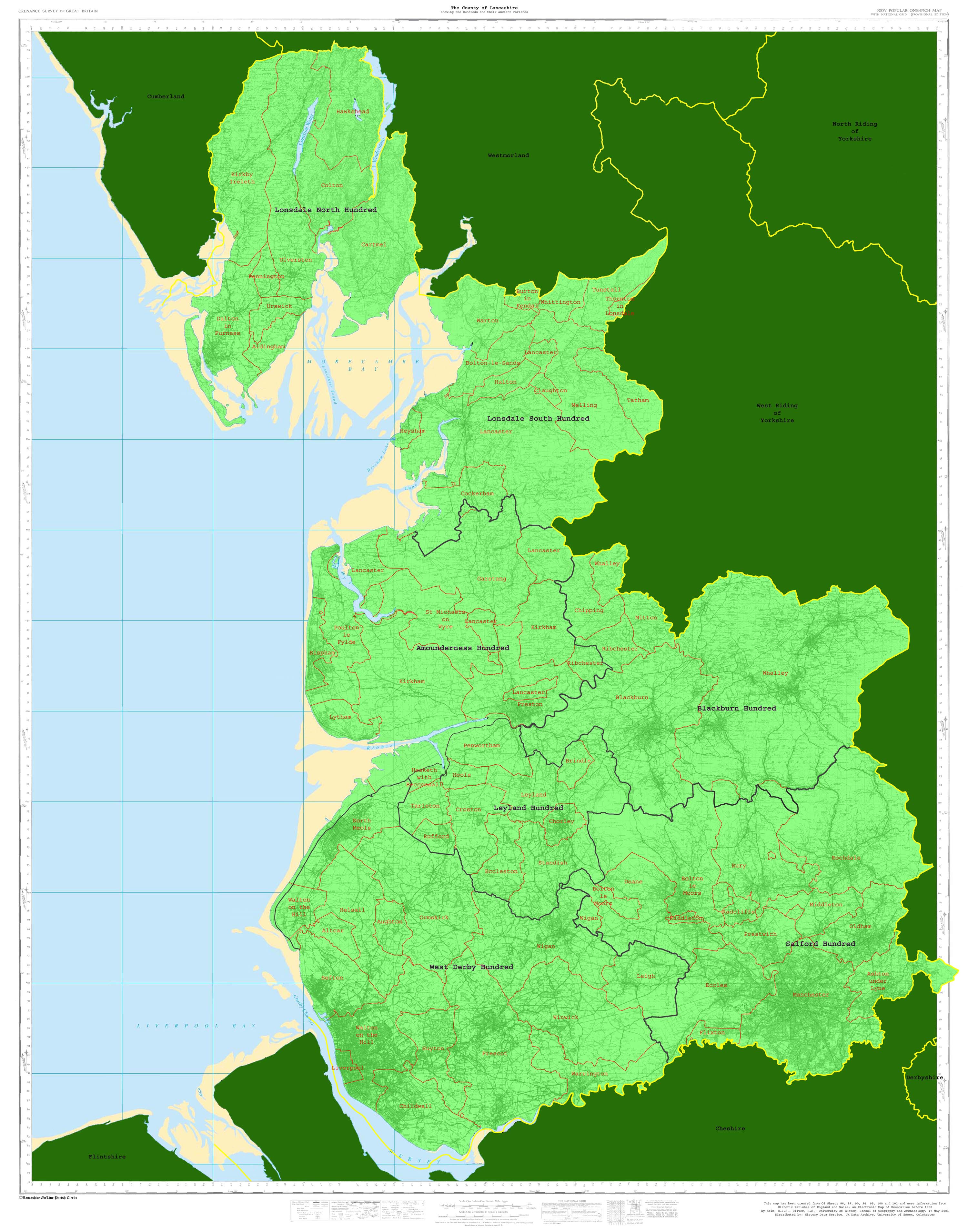 | |
This map has been created from OS Sheets 88, 89, 90, 94, 95, 100 and 101 and uses information from
Historic Parishes of England and Wales: an Electronic Map of Boundaries before 1850
By Kain, R.J.P., Oliver, R.R., University of Exeter. School of Geography and Archaeology, 17 May 2001
Distributed by: History Data Service, UK Data Archive, University of Essex, Colchester
A higher resolution image is available by clicking the link on the image. This file is approximately 1Mbyte in size.
To download this map to your computer, right click and select 'save Target/Link as'.
Do not select 'save image' or you will just get the lower resolution image seen on this page
| ©Lancashire OnLine Parish Clerks |