 |
The Parish of Warton |
|
|
|
The Parish of Warton |
|
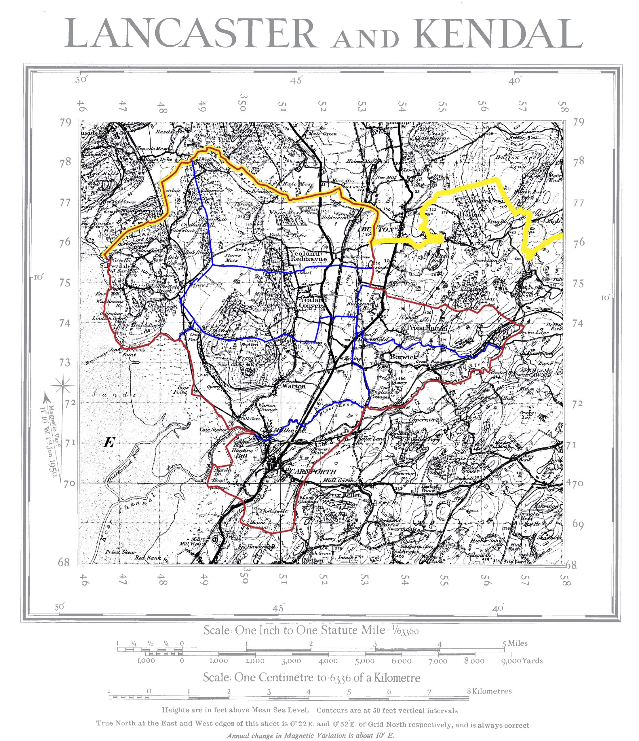
Map of the Parish of Warton
 | |
This map has been created from
Historic Parishes of England and Wales: an Electronic Map of Boundaries before 1850
By Kain, R.J.P., Oliver, R.R., University of Exeter. School of Geography and Archaeology, 17 May 2001
Distributed by: History Data Service, UK Data Archive, University of Essex, Colchester.
The Parish of Warton comprises the townships of Warton, Carnforth, Silverdale, Borwick, Priest Hutton, Yealand Redmayne and Yealand Conyers. The Parish Boundary is marked in red while the boundaries between the individual townships are marked in blue. The County boundary is marked in yellow.
A higher resolution image is available by clicking the link on the image. This file is 1Mbyte in size.
| Warton Home & Contents | ©Lancashire OnLine Parish Clerks | Lancashire Home |