 |
The City of Salford |
|
|
|
The City of Salford |
|
Map of Salford and Surrounding Districts
 | |
This map has been created from
Historic Parishes of England and Wales: an Electronic Map of Boundaries before 1850
By Kain, R.J.P., Oliver, R.R., University of Exeter. School of Geography and Archaeology, 17 May 2001
Distributed by: History Data Service, UK Data Archive, University of Essex, Colchester.
The City of Salford was never a recognised parish, the city having parts in the Parishes of Manchester and Eccles. The Townships of Pendleton and Pendlebury are in the Parish of Eccles while the remainder of the City is in the Parish of Manchester.
A higher resolution image is available by clicking the link on the image. This file is 500Kbytes in size. To download this map to your computer, right click and select 'save Target/Link as'. Do not select 'save image' or you will just get the lower resolution image seen on this page
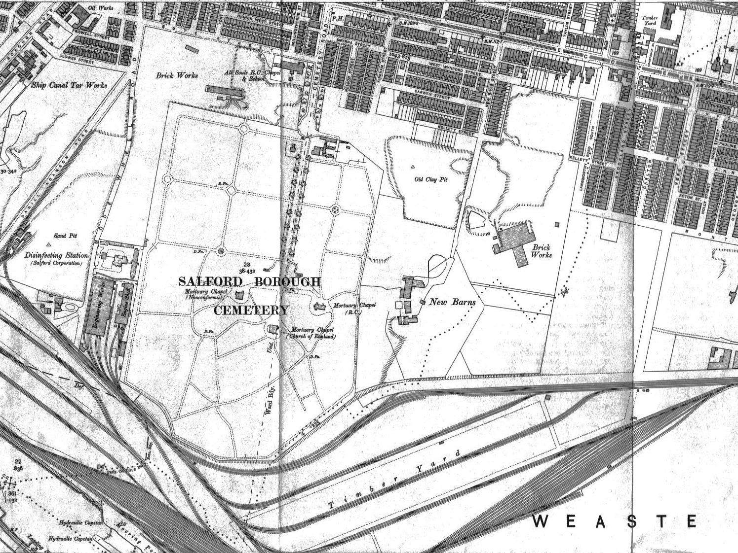
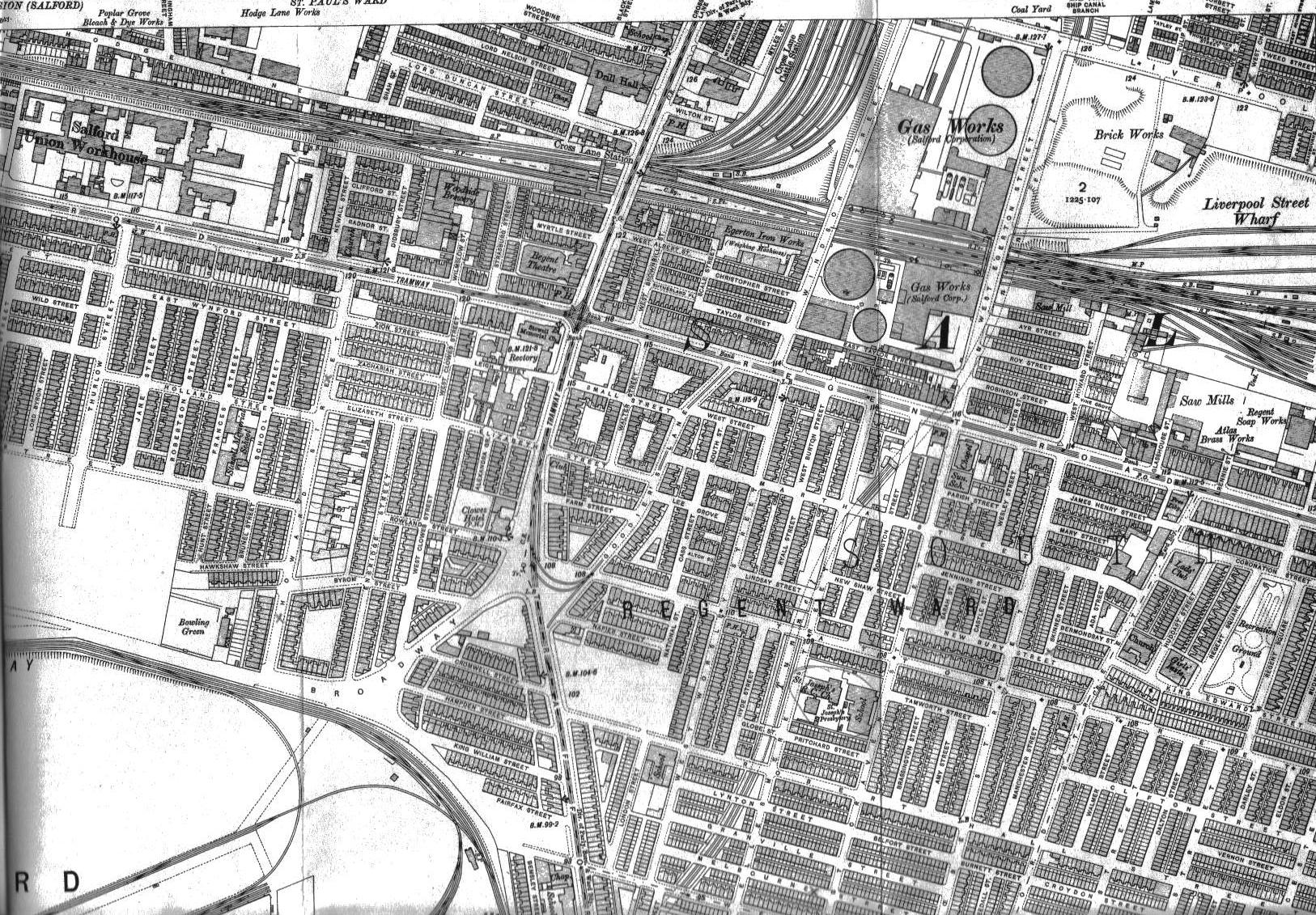
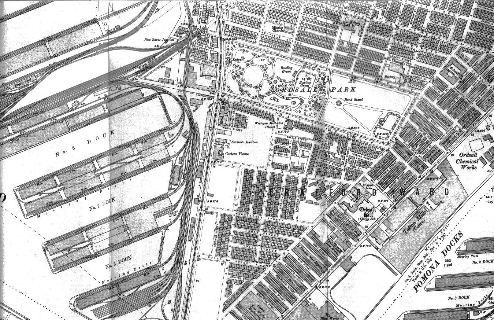
Below is a set of four maps of Salford docks, c1906. Each image is a link to open a larger view of that section of the map in a new window. These images are larger files, ranging in size from 400Kbytes to 700Kbytes. To download the files to your computer, right click and select 'save Target/Link as'. Do not select 'save image' or you will just get the very small image seen on this page.
 |
 |
 |
 |
| Salford Home & Contents | ©Lancashire OnLine Parish Clerks | Lancashire Home |