 |
The
Parish of Garstang |
|
|
|
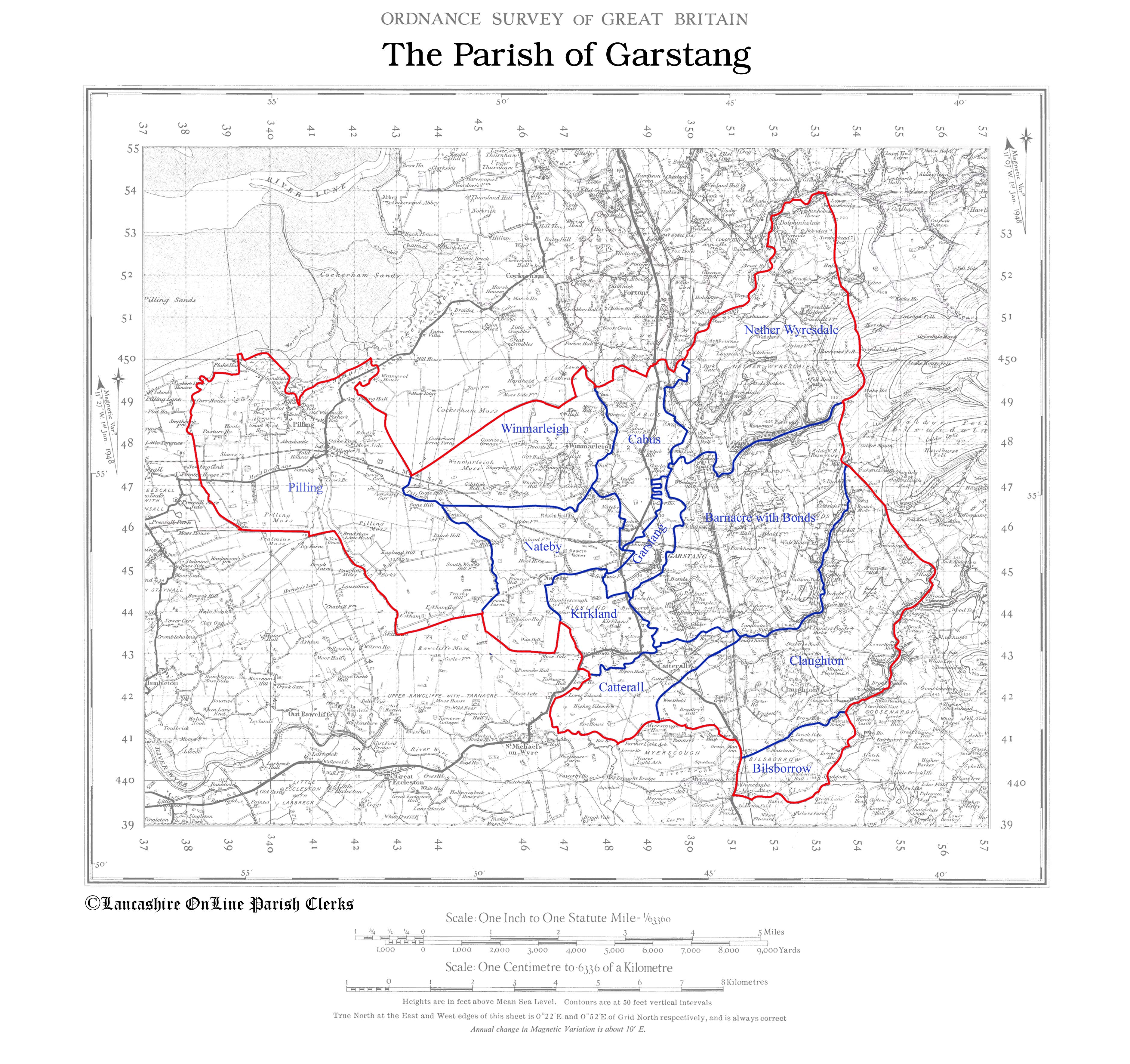
The
Parish of Garstang |
|
 | |
This map has been created from
Historic Parishes of England and Wales: an Electronic Map of Boundaries before 1850
By Kain, R.J.P., Oliver, R.R., University of Exeter. School of Geography and Archaeology, 17 May 2001
Distributed by: History Data Service, UK Data Archive, University of Essex, Colchester.
A higher resolution version of this map is available by clicking the the map above. To save to your computer, right click and select "Save Target/Link As".
Historically, Garstang was a very large parish including the townships of Claughton, Catterall, Kirkland, Nateby, Winmarleigh, Cabus, Barnacre-with-Bonds, Nether Wyresdale (Scorton), Forton, Holleth, Cleveley/Shireshead, Bilsborrow, and Pilling. Records for these places are listed under Garstang with the exceptions of Pilling which has its own registers dating from the 1600s, and Forton and Holleth, parts of which were also in Cockerham parish. The Cockerham registers contain entries for events which took place at Shireshead chapel which people from Forton, Holleth and Shireshead attended.
| Garstang Home & Contents | ©Lancashire OnLine Parish Clerks | Lancashire Home |